As you can see, they hide the truth in plain sight and hope you're not smart enough to catch on. The globe is really a magic trick. When you see things like the international dateline going way out of wack, and wonky time zones depending where you are, you have to step back for a moment and start to consider the possibility that the entire map is wrong. There are some very curious observations to be had when you do.
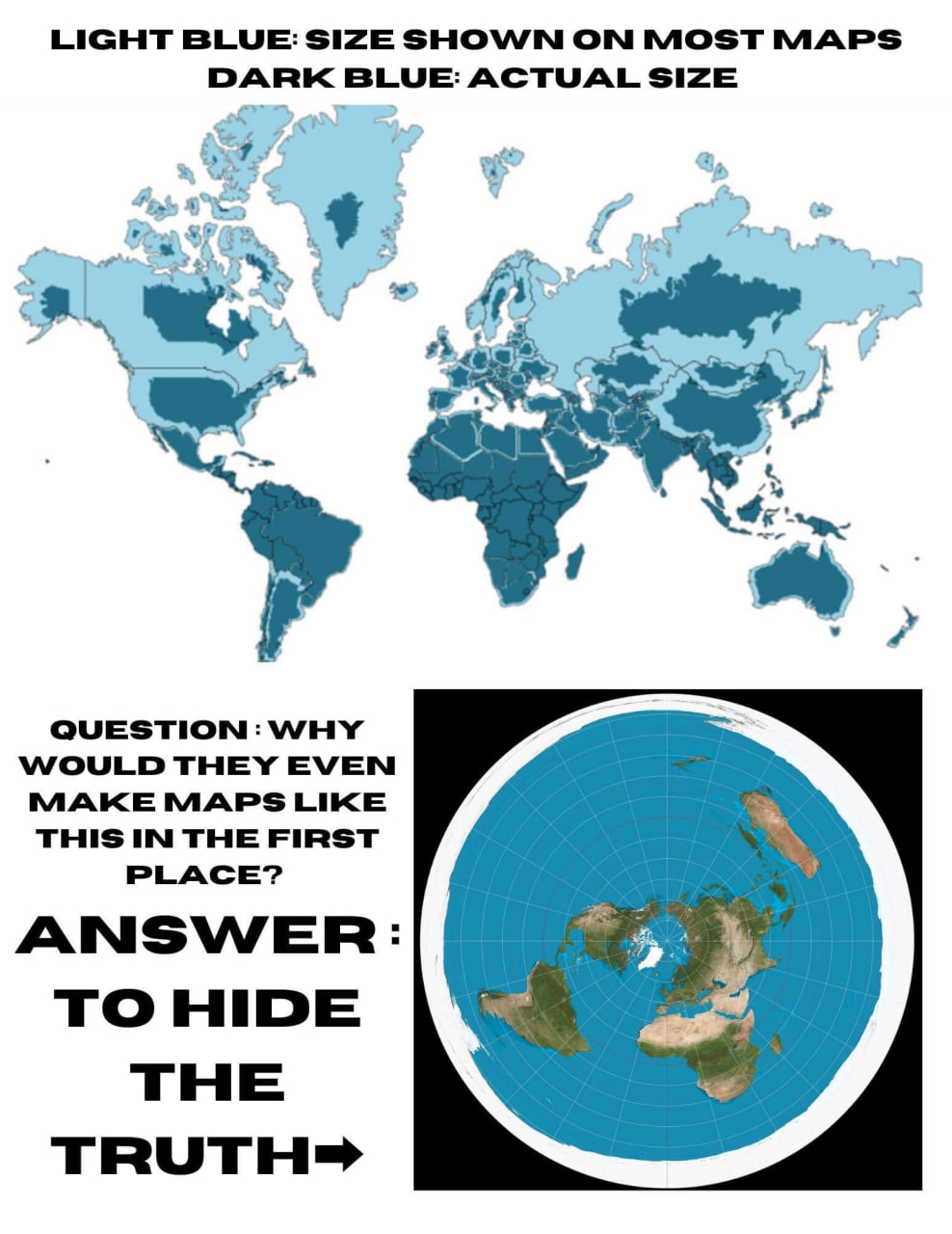
The globe map that we are used to is actually a terrible representation of the land even by globe standards. For example, did you know that Greenland is actually much much smaller than Brazil, despite it being much larger than Brazil if you looked at a globe?
Much of North America and Russia are actually far smaller than we've been led to believe. Canada and America are actually tiny in comparison to Africa. Which means everything we think we know about our world, our maps is completely wrong. If we don't even know the size of the landmass in which we live on, how can we know the layout of our world? What we think we see from all the Globe maps, the image of the world that been ingrained into our brains is wildly inaccurate. Just have a look at this...
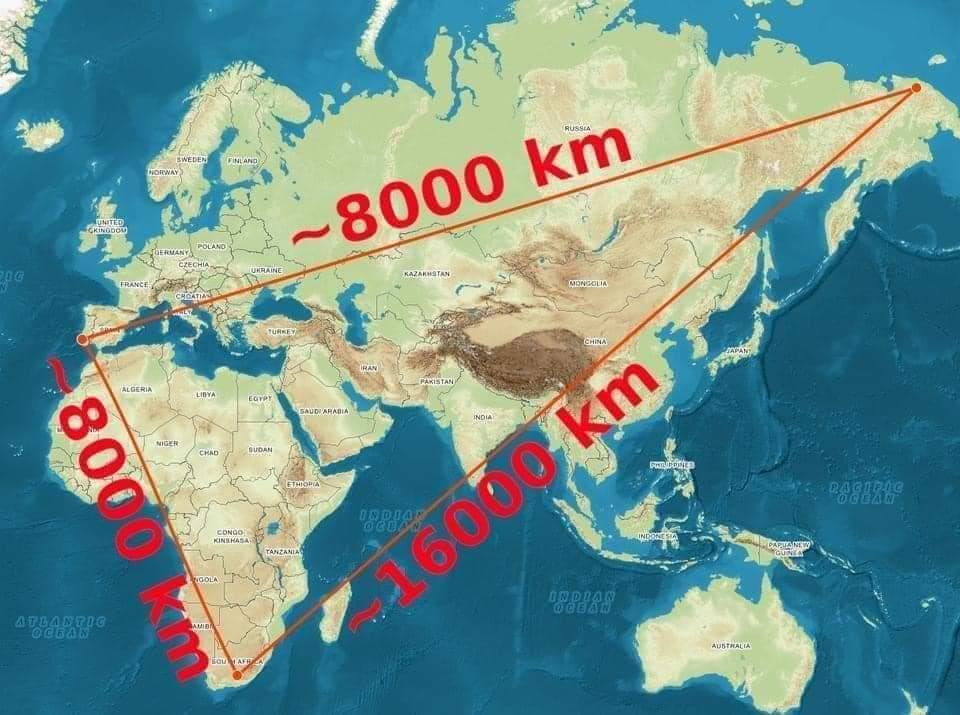
The scale of our world is completely off. This once again aligns with things like the wonky international dateline and the out of place time zones. Remember, we're supposed to be living on a perfect sphere, yet nothing aligns with this idea. It's quite literally as if the Globe was invented and they just couldn't shovel everything under the rug to hide that fact. Just look how wild this is.
More clues emerge when you start to look at navigation. Literally all forms of navigation use a east to west / west to east sense of direction using a compass pointing north to keep us oriented to that same circum-nagivation.
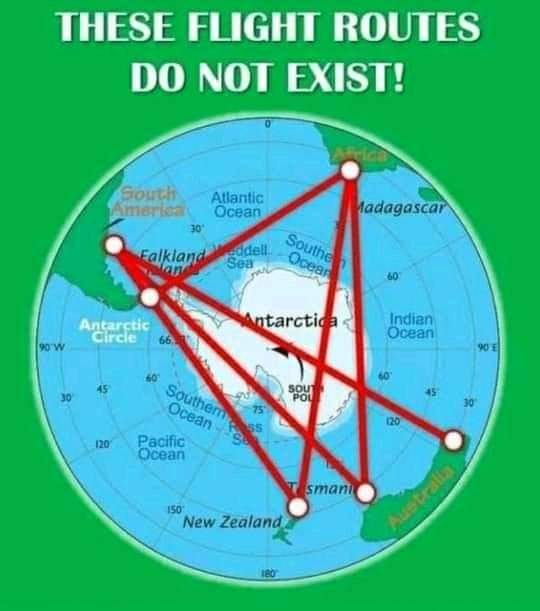
We never see shipping lanes, or plane trips going North to South. There are also no flights that fly over the South pole.
Now these flight routes would make perfect sense if this was how our world really looked like. It would make sense that the shortest distance between two objects is a straight line. That you could fly from South America to Australia directly over Antarctica in a relatively short period of time. The problem is, these flights don't exist, because the distance between these two points is far greater than we've been told or understand. The excuses they give us is that it's too dangerous to fly over Antarctica, as the risk of freezing fuel lines and a lack of emergency landing zones make it too risky. That's just an excuse to avoid having to explain why it's so far away. So they take detour flights around Antarctica instead often wildly going what appears to be way out of the way.
It's almost as if we are going in a circle around a flat plane than we are a Globe.
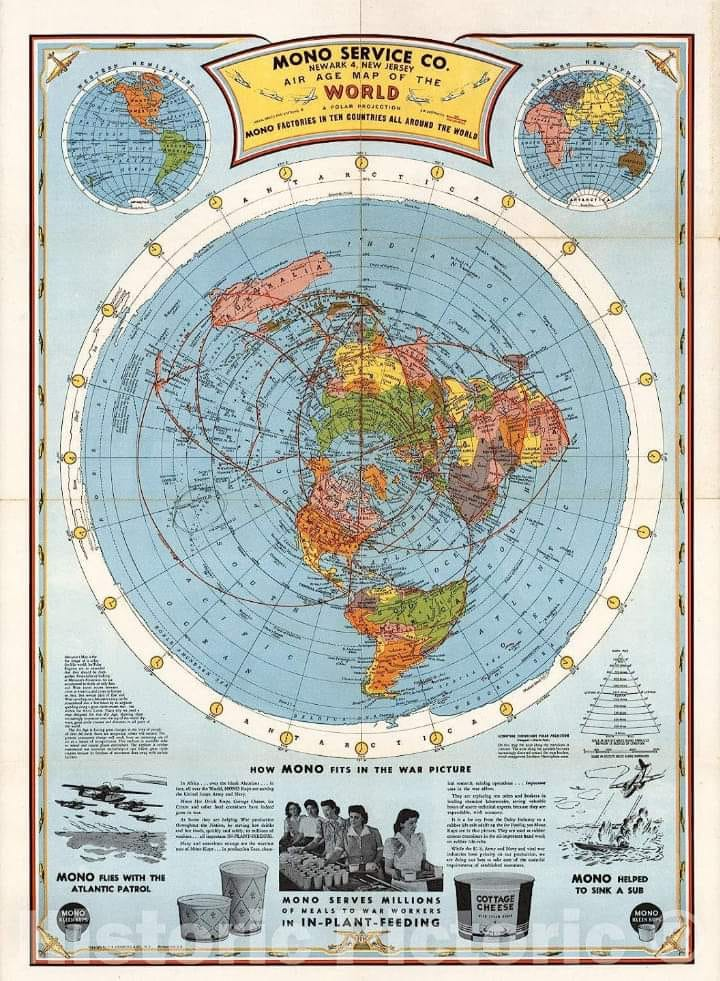
Since there are zero examples of North to South Navigation, this is the only logical conclusion we can come to, and when you start to look at the maps that governments use, we start to confirm the fact that they don't use a globe map for anything. Like this airmap....
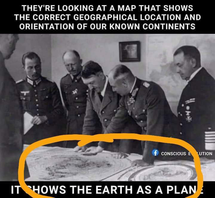
Even Hitler used a Flat Earth map to strategize for war.
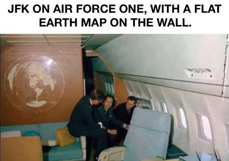
It's gets even weirder still, when you look at JFK's Air Force One and the map it had on the wall.
Or the JFK situation room....
The map on the Air Force One wall even suggests that this Earth contains more landmasses than we would even normally see on the Globe map. But there is one more anomaly that needs to be looked at. An anomaly that blows apart the globe deception, and shows us the true map of our realm. Which will give us a greater understanding about our world.