
A painted line on pavement may look precise, but its reliability depends on the evidence behind it. Sewer line locating in Orange County should distinguish between a probable route, a detectable subsurface response, and a physically verified pipe position before contractors design foundations, cut concrete, excavate repairs, or approve construction near buried infrastructure.
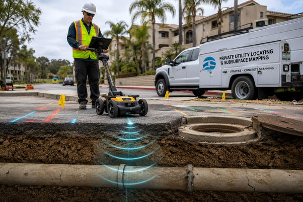
Not Every Sewer Mark Represents the Same Level of Certainty
Locating is not a single measurement.
A sewer route may be inferred from old plans, traced with a camera transmitter, detected through ground penetrating radar, or confirmed by exposing the pipe. Each method produces a different level of confidence, and the project team should understand that difference before relying on the marks.
|
Evidence Source |
What It Establishes |
Main Limitation |
|
Records and as-built plans |
A possible route or connection |
May be outdated or incomplete |
|
Visible cleanouts and manholes |
Known access and surface features |
Do not reveal every bend or branch |
|
Camera with sonde |
Position of the camera head |
Requires pipe access and a passable line |
|
Ground penetrating radar |
Subsurface responses and possible alignments |
Results depend on site conditions |
|
Electromagnetic locating |
Conductive or traceable utilities |
Directly tracing plastic pipe is difficult |
|
Test hole or pothole |
Physical horizontal and vertical position |
Confirms only the exposed point |
This evidence hierarchy reflects the central principle behind subsurface utility engineering: utility information should be collected and documented according to the level of certainty required by the project.
The Federal Highway Administration describes four recognized utility quality levels. Records alone represent the lowest level, surface geophysical methods can establish an approximate horizontal position, and controlled exposure provides the highest level of positional certainty at a specific point.
A utility map should communicate how the line was identified, not merely where someone drew it.
Why Non-Metallic Sewer Pipes Require Multiple Clues
Cast iron and other conductive pipes may sometimes support electromagnetic tracing. Plastic, clay, concrete, and other non-conductive sewer materials do not generate the same direct response.
That makes non metallic sewer pipe locating OC projects more dependent on combined evidence.
A locator may trace a sonde placed inside the sewer, scan for a radar response associated with the pipe or its trench, compare visible plumbing features, and check whether the suspected route leads logically toward a known connection. No single clue should be treated as conclusive when site conditions limit the equipment.
Can Ground Penetrating Radar Find a PVC Sewer Line?
Ground penetrating radar can detect some PVC and other non-metallic pipes, but successful detection is never guaranteed.
Ground penetrating radar, commonly called GPR, sends electromagnetic energy into the ground and records reflections caused by changes in subsurface materials. The Federal Highway Administration states that GPR can detect metallic and non-metallic pipes, but performance varies with burial depth, pipe diameter, backfill, soil composition, pipe condition, and the surface above the target. Clay-rich ground can also reduce effective penetration depth.
A pipe may appear as a direct reflection, a disturbance in the surrounding trench, or a repeated response that follows a consistent alignment.
Ground penetrating radar sewer locating OC work becomes more persuasive when the radar response agrees with cleanouts, plumbing exits, camera distances, surface features, or recorded connection points.
A Sewer Route Is More Than a Series of Dots
A single response does not establish an entire alignment.
Professional private sewer line mapping Orange County projects require enough field data to explain where the pipe begins, how it moves through the property, where it changes direction, and where it approaches the planned construction area.
Connecting widely spaced indications without supporting evidence can create a false sense of accuracy. Earlier American Society of Civil Engineers guidance specifically cautioned against connecting isolated grid responses through guesswork when the spaces between them had not been verified.
A defensible map may include:
-
Accessible cleanouts and manholes
-
Marked sonde positions
-
Suspected bends and branch connections
-
Radar responses following the expected route
-
Approximate depths at selected locations
-
Measurements from permanent site features
-
Areas where the line could not be confirmed
-
The method used to identify each segment
This matters on shopping centers, apartment communities, schools, industrial properties, and office campuses where several private sewer branches may cross shared pavement or landscaped areas.
Sewer Locating and Slab Leak Detection Solve Different Problems
The phrases are sometimes grouped together because both involve hidden pipes, but the investigations are not interchangeable.
Is Slab Leak Detection the Same as Sewer Line Locating?
No. Slab leak detection usually targets pressurized water escaping beneath a slab, while sewer locating traces a gravity drainage pipe and its route.
A pressurized water leak may be investigated through acoustic listening, pressure testing, thermal differences, moisture patterns, or other diagnostic methods. A gravity sewer may not produce the same sound, heat, or pressure behavior.
Projects involving slab leak and sewer line detection OC should define which system is under investigation before equipment is selected. Moisture near a slab can result from a pressurized supply leak, a failed drain, irrigation, groundwater, waterproofing problems, or surface drainage.
Assuming the source too early can send the investigation in the wrong direction.
When a sewer runs beneath reinforced concrete, the technician may also need to distinguish the buried pipe from reinforcing steel, conduits, post-tension cables, and slab features. Concrete scanning and outdoor utility locating involve related technology, but they examine different materials and depths.
Why Public Utility Markings May Not Show the Private Sewer
California’s 811 notification process remains required before qualifying excavation, including work conducted by contractors on private property. However, participating utility operators generally mark only the facilities they own or maintain. DigAlert also notes that owners of certain non-pressurized sewer and drain lines are not required to participate in the regional notification system.
Will an 811 Ticket Identify Every Sewer on the Property?
No. Private laterals, site-owned branches, and some non-pressurized sewer lines may require a separate private investigation.
That is why underground utility locating Orange County projects should begin with a valid DigAlert ticket and then address the gap between public utility markings and privately maintained infrastructure.
Contractors should review California safe-digging requirements before excavation. Public notification and private locating are complementary safeguards, not substitutes for one another.
Match the Confidence Level to the Consequence of Being Wrong
Not every section of pipe requires physical exposure.
A conceptual property plan may rely on records and surface evidence during early planning. A proposed trench crossing a sewer can justify geophysical designation. A footing, bore, retaining wall, or deep excavation placed close to the suspected alignment may require controlled exposure at the conflict point.
When Should a Sewer Line Be Physically Exposed?
Physical exposure is appropriate when the exact horizontal position, depth, size, or material will directly affect design or excavation safety.
Vacuum excavation, sometimes called potholing, removes soil through air or water pressure and vacuum recovery to expose a limited portion of the utility with less risk than uncontrolled mechanical digging. The exposed point can then be surveyed and added to the project record.
The Federal Highway Administration identifies this physical verification as the highest utility information level because it provides precise horizontal and vertical data at the point of exposure.
The rest of the route may still rely on surface geophysics. The objective is not to expose every foot of sewer but to apply stronger verification where a wrong assumption would create the greatest cost or safety risk.
What a Defensible Orange County Sewer Map Should Show
A useful deliverable separates observed facts from interpreted findings.
Confirmed cleanouts should not be displayed the same way as suspected branches. Sonde-traced sections should be distinguished from radar-only responses. Approximate depth readings should not be presented as physically verified elevations.
For construction planning, the final record may include field markings, photographs, route measurements, depth estimates, investigation notes, survey data, and clearly defined areas of uncertainty.
Superior Scanning provides private utility locating and subsurface mapping for commercial, residential, engineering, and construction projects throughout Orange County.
Reliable sewer line locating in Orange County is not defined by how many marks appear on the ground. It is defined by whether each mark carries enough evidence for the decision being made.