Die geographische Position der Amundsen Scott South Pole Station, Antarctica ist lt. Google Earth Pro nicht exakt auf 90° S

Hier die Aufnahme des Funkraumes mittels Google Earth
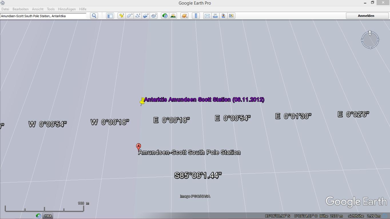
Sie befindet sich lt. Google Earth an einer anderen Stelle in der Antarktis

Die Amundsen Scott South Pole Station befindet sich anscheinend am 85. Breitengrad, genauer 85°06' S, 0°00' E
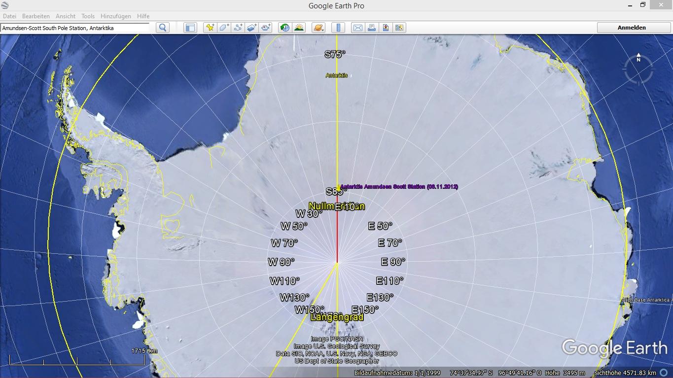
Die exakte Entfernung der Amundsen-Scott South Pole Station bis zum geographischen Südpol, beträgt somit (rote Linie) 547.48 km
Es stellt sich nun die Frage: Was möchte uns Google Earth damit sagen? ... ;)
--------------------------------------------------------------------------------------------------------------------------------------------------------------------------------------
Hinweis: Bei Google Earth exakt dies eingegeben, "Amundsen Scott South Pole Station, Antarctica", ansonst tut sich gar nichts!
Optische Infos: Amundsen Scott Station Webcam (Seehöhe: 2834,945 m), Aufnahme vom 23.01.2015, https://tinyurl.com/ycaesddy
Aktuelle Webcams: Amundsen Scott South Pole Station, Antarktika
https://www.webcamgalore.de/webcam/Antarktis/Suedpol/342.html
https://www.usap.gov/videoClipsAndMaps/spwebcam.cfm
https://www.esrl.noaa.gov/gmd/obop/spo/livecamera.html
Aktuelle Aufnahmen der Pole:
Antarctica Mosaic - Terra 1km True Color 2018/312 (11/08)
https://lance-modis.eosdis.nasa.gov/imagery/subsets/?mosaic=Antarctica.2018312.terra.1km
Arctic Mosaic - Terra 1km True Color 2018/313 (11/09)
https://lance-modis.eosdis.nasa.gov/imagery/subsets/?mosaic=Arctic.2018313.terra.1km
Bildquelle: https://earthdata.nasa.gov/earth-observation-data/near-real-time/rapid-response