Understanding the underwater terrain is vital for many industries, from construction and engineering to environmental conservation. Bathymetric surveys, which measure the depth and shape of underwater surfaces, have become an indispensable tool in these domains. At Epitome, we specialize in providing accurate and efficient bathymetric survey services tailored to meet your needs.
What is a Bathymetric Survey?
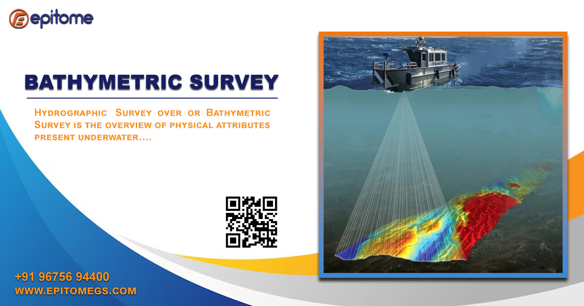
A bathymetric survey is the underwater equivalent of a topographic survey. It involves mapping the submerged terrain of water bodies, such as rivers, lakes, oceans, and reservoirs. Using advanced equipment like multi-beam and single-beam echo sounders, along with GPS technology, bathymetric surveys create precise 3D models of underwater environments.
Why Choose Epitome for Bathymetric Surveys?
At Epitome, we pride ourselves on leveraging cutting-edge technology and expert personnel to deliver unmatched bathymetric survey services. Here's why we are your best choice:
- State-of-the-Art Equipment
Our team employs advanced sonar systems, including multi-beam echo sounders, to collect high-resolution data. This ensures precision even in challenging underwater conditions. - Experienced Team
With years of experience in geotechnical and geophysical surveys, our specialists deliver comprehensive analysis and actionable insights tailored to your project's goals. - Customizable Solutions
We understand that every project is unique. Our bathymetric survey solutions are customizable to meet specific requirements, whether it's for dredging, navigation, or environmental studies. - Nationwide Coverage
Epitome operates across India, providing services to diverse industries, including oil and gas, marine construction, and environmental conservation.
Applications of Bathymetric Surveys
Bathymetric surveys are critical in various fields, such as:
- Port and Harbor Development: Ensuring safe navigation by mapping channels and berths.
- Dredging Projects: Identifying areas requiring excavation for improved water flow.
- Environmental Studies: Monitoring underwater ecosystems and sediment movement.
- Hydrographic Mapping: Creating nautical charts for marine transportation.
- Infrastructure Projects: Supporting bridge and dam construction with accurate underwater data.
Why Bathymetric Surveys Matter
A clear understanding of underwater topography minimizes risks and improves project outcomes. Whether you’re planning a construction project or monitoring marine environments, the accuracy of a bathymetric survey can save time, reduce costs, and ensure compliance with regulations.
Contact Us
For reliable and efficient bathymetric survey services, partner with Epitome today. Visit our website www.epitomegs.com or call us at +91-96756 94400 to discuss your project requirements.
Experience precision with Epitome, your trusted partner in geotechnical and geophysical services.
#BathymetricSurveyCompanyinIndia
#BathymetricSurveyinIndia
#BathymetricSurvey
#Bathymetric
#epitome